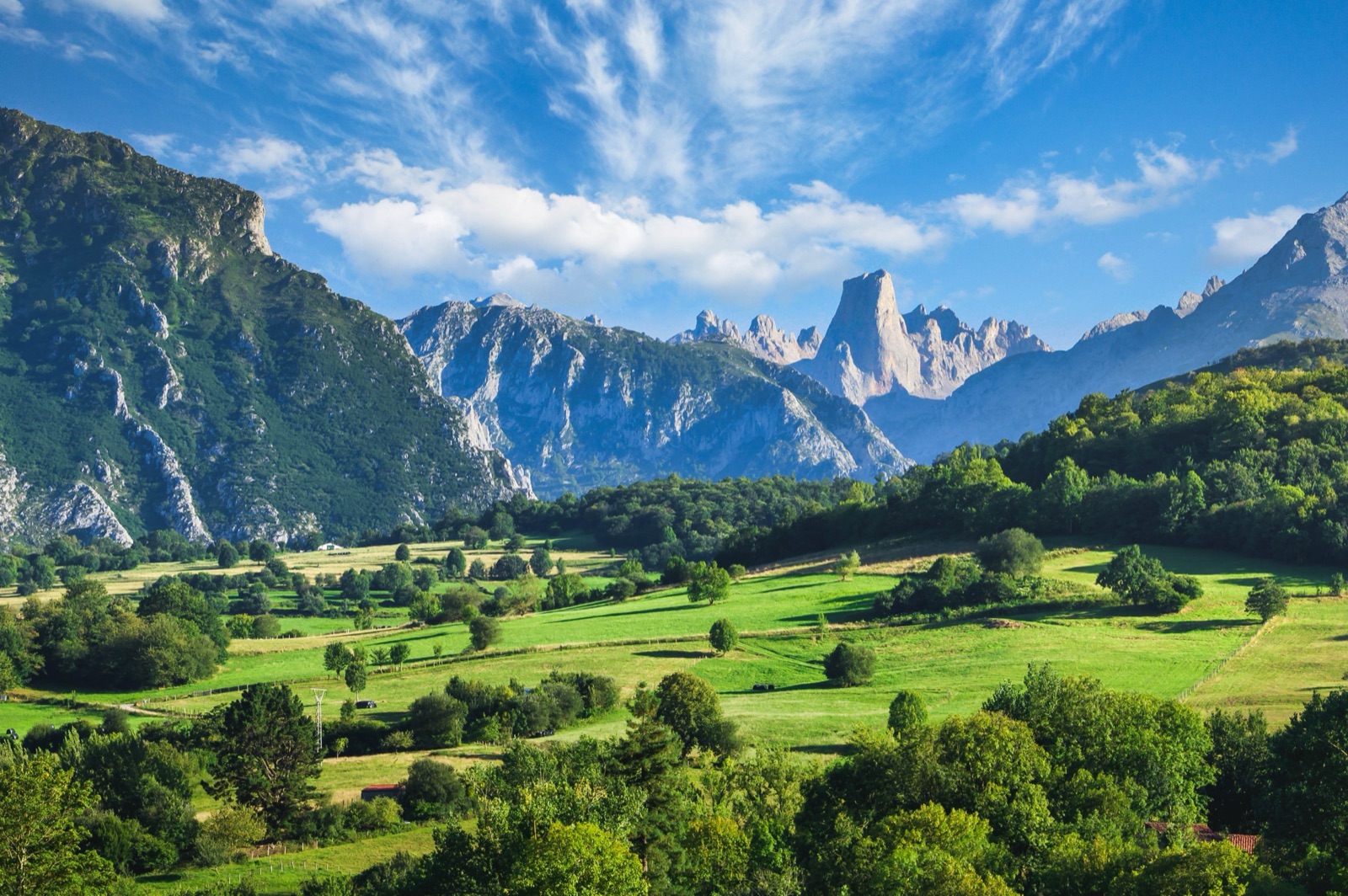
Anillo de Picos: The Hut-to-Hut Trek Through the Picos de Europa Refuges
The Anillo de Picos is the classic multi-day hut-to-hut trek in the Picos de Europa: a ring of mountain paths that links the eight mountain refuges of the Picos, with 9,000 m of ascent over 115 km. It was designed by the refuge guardians to showcase the sporting, environmental and cultural appeal of the Picos, it can be started from any of the refuges and walked in either direction, and it comes in shorter versions that cover one or two of the three massifs. It is a serious mountain route, not a valley walk: expect long days on rough limestone, frequent fog and, outside summer, snow.
This guide explains the versions, the stages and their times, the refuges and their seasons, how booking works, and what you need to carry. For shorter walks, see our hiking article and the guide to the Cares route and Bulnes.
The Anillo de Picos at a glance
| What | A circuit linking the mountain refuges of the Picos |
| Full ring | 9,000 m of ascent over 115 km |
| Versions | Anillo Vindio (4 stages), Anillo Extrem (7 stages), Anillo 3 Macizos (9 stages) |
| Start | Any refuge, either direction |
| Season | The guarded season, broadly May to October for most refuges |
| Booking | Refuge places are booked through reservarefugios.com |
| Difficulty | High-mountain terrain, some exposed sections with fixed rope |
The three versions
The versions are the Anillo Vindio (western massif, 4 stages), the Anillo Extrem (western and central, 7 stages) and the Anillo 3 Macizos (all three massifs, 9 stages). It can be walked independently in full, over eight or nine days, or in three sectors, one per massif.
How to choose:
- Anillo Vindio stays in the western massif, the Cornión, above the Lakes of Covadonga. It is the gentlest introduction and the shortest.
- Anillo Extrem adds the central massif, the Urrieles, with the Naranjo de Bulnes and the highest peaks. For the Extrem version walkers cut across to Urriellu by the Horcados Rojos cable.
- Anillo 3 Macizos links all three massifs, including the eastern massif, Ándara, and is the full ring.
A published description gives a slightly different total for the full itinerary, so treat any single figure as approximate: lengths depend on the variants you choose and where you start.
Where to start
The guardians recommend starting with the western or eastern massif, which are technically gentler, before the central massif. That way your first days are on easier ground, your legs are adapted by the time you reach the hardest passes, and you have a better sense of the fog and terrain.
In practice most people start from:
- The Lakes of Covadonga, walking up to Vega de Ario or Vegarredonda. The PR-PNPE 4 to Vega de Ario is 7.6 km one way from Buferrera.
- Sotres or the Pandébano col, for the central massif and Urriellu.
- Poncebos, climbing to Vega de Ario by the Canal de Trea. Another common route to Vega de Ario climbs the steep Canal de Trea, with 1,200 m of ascent.
The stages and times
The route’s own site lists the stages of the full ring between refuges, with walking times. They do not include stops, and they assume good conditions.
| Stage | Via | Time |
|---|---|---|
| Vega de Ario to Vegarredonda | Vega de Aliseda and Llampamala | 4–6 hours |
| Vegarredonda to Vegabaño | Fuente Prieta, Vega Huerta, Canal del Perro | 8–10 hours |
| Vegabaño to Collado Jermoso | Dobres pass, Canal de Asotín | 7.5 hours |
| Collado Jermoso to Cabaña Verónica | Tiro Casares | 2.5 hours |
| Cabaña Verónica to Casetón de Ándara | Áliva | 8 hours |
| Casetón de Ándara to Vega de Urriellu | Sotres | 8 hours |
| Vega de Urriellu to Jou de los Cabrones | Horcada Arenera | 2 hours 45 minutes |
| Jou de los Cabrones to Vega de Ario | The Cares path and Canal de Trea | 10–11 hours |
A few stages stand out. Vegarredonda to Vegabaño and Jou de los Cabrones back to Vega de Ario are very long days: leaving Jou de los Cabrones, some exposed sections are protected with fixed rope, and the descent drops all the way to the Cares gorge before climbing again. The short stages, such as Collado Jermoso to Cabaña Verónica, are short in time but high and rocky.
Distances and climbs for the first stages
Another published description of the ring gives distances and height gain for the western stages:
- Stage 1: Vega de Ario to Vegarredonda, 8 km with 360 m up and 560 m down.
- Stage 2: Vegarredonda to Vegabaño, 16.4 km with 1,460 m up and 1,320 m down.
- Stage 3: Vegabaño to Collado Jermoso, 17.8 km with 1,380 m up and 820 m down.
Those climbs show why the times are long: on the Anillo, the height matters far more than the distance.
The refuges
The Anillo is built around the refuges. Most refuges are guarded for part of the year, with food and bunks with blankets; when the guardian is away part stays open, and places should be booked in advance.
| Refuge | Massif | Height | Notes |
|---|---|---|---|
| Vega de Ario | Western (Asturias) | 1,630 m | 40 bunk beds, May to October |
| Vegarredonda | Western (Asturias) | 1,470 m | 68 places, guarded all year |
| Vegabaño | Western (León) | 1,432 m | 35 places, closed mid-January to March |
| Collado Jermoso | Central (León) | 2,067 m | 40 places, guarded May to October |
| Cabaña Verónica | Central (Cantabria) | 2,325 m | A tiny hut: the metal dome of an old aircraft carrier |
| Casetón de Ándara | Eastern (Cantabria) | 1,725 m | Reached from Sotres towards Escarandi |
| Vega de Urriellu | Central (Asturias) | 1,960 m | 96 places, 15 March to 15 December |
| Jou de los Cabrones | Central (Asturias) | 2,100 m | 24 places, May to October, emergency radio |
The heights come from the route’s own refuge list; the park’s list gives some of them slightly differently. Two other refuges are useful on variants or as bail-out points: the Terenosa refuge by the Pandébano col has 30 places, open May to October, without radio or meals, and the Áliva refuge-hotel, at 1,666 m, has 70 places in rooms and opens from May to September.
Out of season
Outside the guarded season the Urriellu refuge keeps a bivouac area with 6 bunks and blankets. Other refuges keep a smaller free section when the guardian is away. Do not count on these: they are emergency shelters, not a booking.
Highlights along the way
Every stage has its moment, but a few places are the reason people come back.
- Vega de Ario. Vega de Ario is an excellent viewpoint over the peaks of the central massif and the Valdeón valley. An hour and thirty minutes’ walk from the Ario refuge reaches the top of the Jultayu (1,940 m), a viewpoint 1,500 m above the Cares gorge. It makes a fine evening or early-morning side trip if the sky is clear.
- Vegarredonda and Ordiales. The Vegarredonda refuge is the halfway point of the route to the Mirador de Ordiales, where the remains of the Marquis of Villaviciosa, founder of the Montaña de Covadonga national park, rest. The park recommends walking all the way to Ordiales whenever there is visibility.
- Horcados Rojos. On the Extrem shortcut you pass the Horcados Rojos col. The last climb to the col is a steep, stony path, and in snow, ice or fog the park says not to attempt the route.
- Urriellu. The Naranjo de Bulnes (Picu Urriellu) rises to 2,519 m, and its west face is a vertical wall of 550 m. Sleeping at its foot is the emotional high point of the ring for many walkers.
Hazards on familiar paths
Some of the stages share paths with popular day walks, and the park’s warnings for those walks apply to the Anillo too. On the way back from Vega de Ario the park warns walkers to watch for the Llaguiellu turn-off and to follow the paint marks. With snow or ice the route can be dangerous at Collado Vallejo, on the way to Urriellu. And the Cares itself runs through a karst massif where rocks constantly break loose and can fall from hundreds of metres above.
The long alternative: the Ruta de la Reconquista
If you would rather cross the Picos than circle them, the park’s own long-distance route is the Ruta de la Reconquista, numbered GR-PNPE 202. The full Ruta de la Reconquista, Covadonga to Cosgaya, is 58.6 km, and the full route climbs 2,873 m. It must be split into at least three stages: Covadonga to Poncebos, Poncebos to Sotres and Sotres to Cosgaya. There are no mountain refuges along the Poncebos–Covadonga stage, so it must be planned to finish in daylight. It is a good choice for walkers who want a linear route that ends in a valley village.
Booking and the passport
Refuge places are booked through reservarefugios.com. You can book each refuge yourself, or book the whole circuit with a mountain guide. Booking through the scheme includes a T-shirt, the route map and a passport to stamp at each refuge.
Book early for July and August, when the popular refuges such as Urriellu and Vega de Ario fill. If the weather forces a change of plan, call the refuges you are skipping so your bunk goes to someone else.
Travelling light
The recommended style is to sleep and eat in the refuges, without bivouac gear or cooking pots. That keeps your pack light enough for the steep passes. What to carry:
- Navigation: carry maps, a compass and good kit (boots, clothes for cold and rain, water, food, a basic first-aid kit), as the weather can change unexpectedly.
- Water: the karst landscape makes the upper zones extremely dry, so carry water.
- Warm and waterproof layers: the park’s weather is unreliable, so it is always worth carrying a light waterproof.
- A sleeping bag liner: refuges provide blankets.
- Offline tracks: GPS tracks for most of the waymarked paths can be downloaded from the park’s website.
When to go
The guarded season is the season for the Anillo, broadly May to October for most of the refuges. Within that:
- Early season brings snow on the high passes. Snow can block the way, especially in the upper section, on routes such as Vega de Ario.
- Mid-summer is the most reliable, though in summer, thick fog can rise even on sunny days.
- Autumn is quieter, with shorter days and the refuges starting to close.
In winter and spring the range is very technical; good navigation and use of ice axe and crampons are essential. Enter areas of snow or ice only with the right equipment: crampons and ice axe. Check our weather page and the park’s avalanche bulletins before you set off.
Fog and safety
Fog is the hazard that catches most people out. At altitude, very thick fogs, known locally as encainadas, are very frequent, even in summer. If fog catches you, the park says the wisest thing is to find a little shelter and wait for it to clear, even if that takes hours. If lost in fog, stay calm and ask for help; never try to move on at night over unknown ground.
The park’s safety advice for walkers:
- Plan and tell someone. Plan walks, check the forecast and never walk alone, or leave word of your route.
- Leave a note in the car. If you leave your car for several days, put a note behind the windscreen with your route and dates.
- Learn to turn back. Check the forecast, watch for sudden changes in the weather and learn to turn back.
- Know the emergency number. Mobile coverage in the Picos is limited, but the connection to 112 is much wider. If you may be becoming hypothermic, call 112.
Rules on the route
The Anillo crosses the national park, so the park rules apply all the way round:
- Camping: wild camping is not allowed in the national park; bivouacking is allowed above 1,600 m. Bivouac tents may be put up an hour before sunset and must be taken down an hour after sunrise.
- Fires: lighting fires without permission is prohibited.
- Dogs: dogs may not be let off the lead in the national park.
- Paths: plan walks and keep to the established paths.
For campsites in the valleys before or after the trek, see our camping guide.
Getting to the start and back
Most walkers arrive at Cangas de Onís for the lakes or at Arenas de Cabrales for Poncebos and Sotres. In summer the lakes road is closed to cars and you go up by bus: the transport plan carries at most 3,000 bus passengers a day, so buying in advance is recommended. From Arenas, a summer bus runs to Poncebos and on to Sotres. Our guide on how to get to the Picos de Europa covers the connections, and the where to stay guide helps with a base for the nights before and after.
Not ready for the full ring?
The Anillo is a big undertaking. If you want a taste of the high Picos first:
- Walk to a single refuge and back. The Vega de Urriellu refuge stands at 1,960 m, under the Naranjo de Bulnes; the walk from Sotres takes 4 hours up and 8 hours there and back, and it can be done in two stages by sleeping at the refuge.
- Take the cable car up and walk down. The Puertos de Áliva route from the upper station (El Cable) down to Fuente Dé is 14.5 km, and its difficulty is low.
- Join a guided day. The tours page lists guided days to Bulnes with the funicular and other trips into the park.
Frequently asked questions
How long is the Anillo de Picos? The full ring links the eight mountain refuges of the Picos, with 9,000 m of ascent over 115 km, usually over eight or nine days.
Can I do only part of it? Yes. The Anillo Vindio covers the western massif in 4 stages, and the ring can also be walked in three sectors, one per massif.
Where should I start? The guardians recommend starting with the western or eastern massif, which are technically gentler, before the central massif.
How do I book the refuges? Refuge places are booked through reservarefugios.com.
Do I need to carry a tent? No. The recommended style is to sleep and eat in the refuges, without bivouac gear or cooking pots.
Is it possible in winter? Only for experienced mountaineers. In winter and spring the range is very technical; good navigation and use of ice axe and crampons are essential.