Picos de Europa Map: The Three Massifs, Regions, Valleys and Where to Start
The Picos de Europa are three blocks of limestone, split by two deep river gorges, sitting where Asturias, Cantabria and León meet. The western massif rises above Cangas de Onís and the Lakes of Covadonga, the central massif holds the highest peaks and the Naranjo de Bulnes, and the smaller eastern massif looks down on the Liébana valley and Potes. Once you have that picture in your head, the map makes sense: every sight you have heard of sits on one of three sides of the range, and the roads go round the mountains, not through them.
This guide walks you round the map. It explains the massifs and the rivers that separate them, the regions and municipalities, the gateway towns on each side, the visitor centres and the viewpoints you can reach by car, and how to choose which side to start from. For the detail of each area, follow the links to the guides on the Lakes of Covadonga, the Cares route and Bulnes and Fuente Dé and Liébana.
The Picos de Europa at a glance
| Massifs | Western (Cornión), central (Urrieles), eastern (Ándara) |
| Size of the range | About 20 km north to south and 35 km west to east |
| Highest peak | Torrecerredo, 2,648 m, in the central massif |
| National park | 66,030.36 ha in Asturias, León and Cantabria |
| Founded | 24 July 1918, as the Montaña de Covadonga |
| Biosphere Reserve | Since 2003 |
| Distance to the sea | Barely 15 km at the northernmost point |
The national park descends from Spain’s first national park, the Montaña de Covadonga, declared by law on 24 July 1918. It has been a Biosphere Reserve since 2003, and it is the second most visited national park in Spain. The Picos are the largest limestone formation in Atlantic Europe, with chasms more than 1,000 m deep and clear signs of glacial erosion.
What surprises most first-time visitors is how compact it all is. The range is a roughly rectangular block about 20 km from north to south and about 35 km from west to east, yet fourteen summits exceed 2,600 m, forty exceed 2,500 m and almost 250 exceed 2,000 m. At their northernmost point the Picos are barely 15 km from the sea, which is why the clouds that roll in off the Bay of Biscay so often wrap the peaks in fog.
How to read the map: rivers draw the lines
The simplest way to understand the Picos is to follow the water. The range is bounded by the Sella and Dobra rivers to the west and the Deva to the east. Inside that frame, two rivers have cut the gorges that split the limestone into three. The Cares separates the Cornión from the Urrieles, and further east the Duje separates the Urrieles from the Ándara massif.
So on any map you can trace:
- The Dobra and Sella on the west, below the western massif and the road from Cangas de Onís.
- The Cares gorge running north between the western and central massifs, from the Valdeón valley in León down to Poncebos in Asturias. The famous Cares route follows it.
- The Duje valley between the central and eastern massifs, climbing from Poncebos towards Sotres and the high pastures of Áliva.
- The Deva on the east, flowing north through Liébana and the Hermida gorge. The Hermida gorge, almost 22 km long and carved by the river Deva, is the longest gorge in northern Spain.
Roads follow these valleys around the outside of the massifs and up into a few of them, but no road crosses the high limestone. That is the key planning fact: moving from one side of the Picos to another means driving round, and a trip that looks short as the crow flies can take most of a morning.
The western massif: Cornión
The western massif is called the Cornión after the horn shape of its silhouette seen from the west. It is the side most visitors see first, because it holds the Lakes of Covadonga and the sanctuary of Covadonga.
Its highest point is the Peña Santa. In the western massif the Peña Santa, at 2,596 m, stands 110 m above the next summit of the massif. The lakes sit on its northern edge: Lakes Enol and Ercina lie at 1,070 and 1,108 m, reached from the sanctuary by a winding 12 km road. Access to the Lakes of Covadonga is regulated in 2026 from 1 June to 18 October and on 24, 25 and 31 October, and on those dates you go up by bus from Cangas de Onís.
What you can do here without serious mountain experience:
- Visit the basilica and Holy Cave at Covadonga.
- Ride the lakes bus and walk the easy circuits around Enol and Ercina.
- Walk on to the Vega de Ario or the Mirador de Ordiales if you are fit and the day is clear.
The Lakes of Covadonga guide covers the access rules and walks in detail.
The central massif: Urrieles
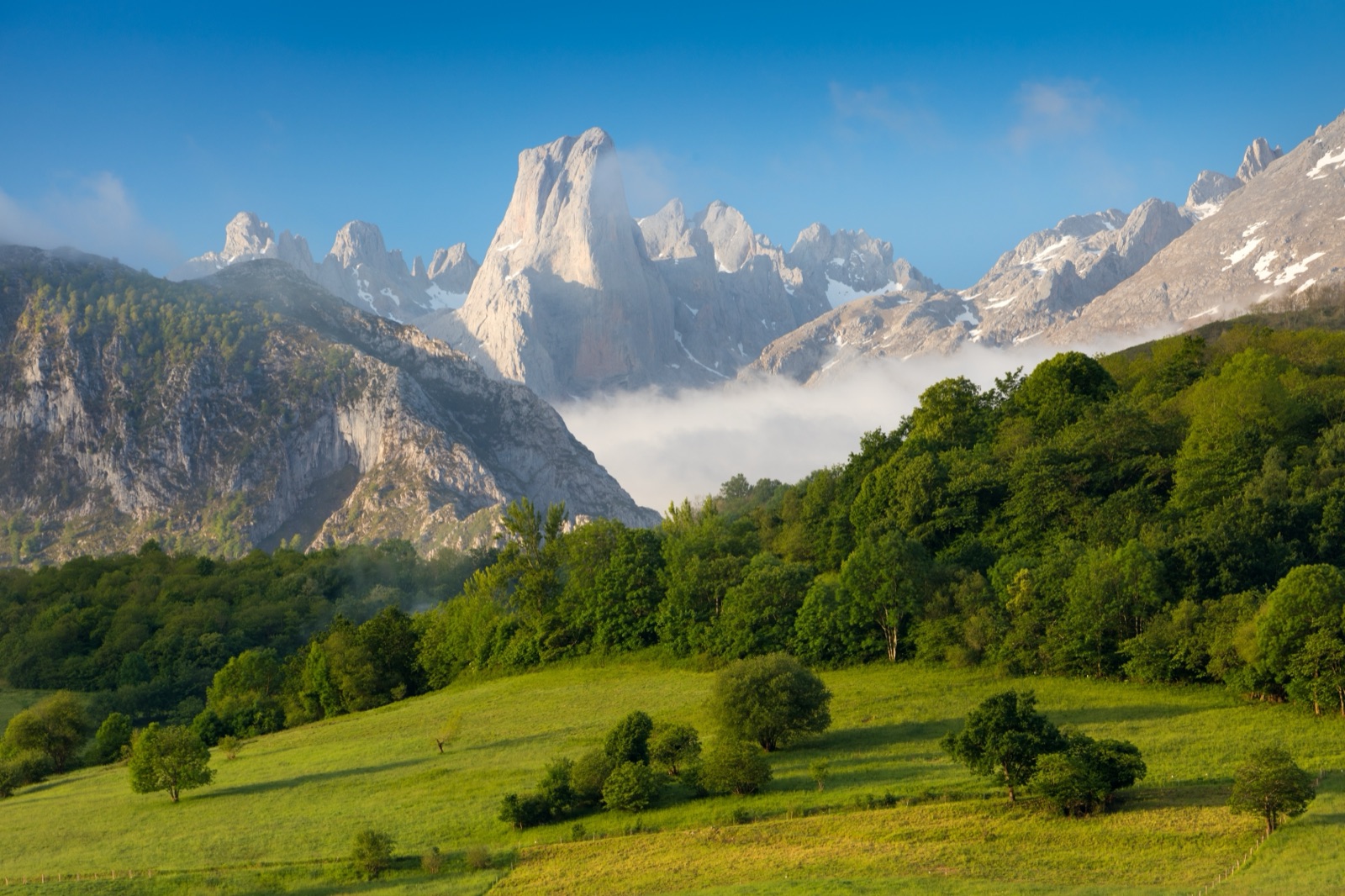
The central massif, the Urrieles, is the most rugged of the three and holds the highest summits. Torrecerredo, at 2,648 m, is the highest peak in the national park. Beside it rises the mountain most people picture when they think of the Picos: the Naranjo de Bulnes (Picu Urriellu) rises to 2,519 m, and its west face is a vertical wall of 550 m.
The central massif is ringed by three very different gateways:
- Poncebos and Bulnes in the north, at the Asturian end of the Cares gorge, where the funicular climbs to Bulnes.
- Caín and the Valdeón valley in the south-west, the León end of the Cares route.
- Fuente Dé in the south-east, in Cantabria, where the cable car lifts you onto the plateau. The Fuente Dé cable car climbs 753 m to 1,823 m in about 4 minutes.
From Sotres, one of the highest villages in Asturias, a road climbs on towards the Pandébano col, the classic start for walkers heading to the Naranjo. The Pandébano col lies at 1,212 m.
The eastern massif: Ándara
The eastern massif, named after the Ándara cirque, is the most modest of the three; its highest point, the Morra de Lechugales, reaches 2,444 m. It is quieter, with old mining tracks across its slopes, and it is best seen from below: from Potes, from Santo Toribio and from the Liébana roads. The Santo Toribio viewpoint looks at the south face of the eastern massif.
If you are staying in Liébana, the Ándara massif is the wall you see in the morning. Walkers reach its refuge, the Casetón de Ándara, from Sotres towards Escarandi.
Three regions, eleven municipalities
The park crosses three autonomous communities, and the map changes language and road numbers as you cross from one to the next. The national park covers 66,030.36 ha in Asturias, León and Cantabria.
| Region | Municipalities in the park’s area |
|---|---|
| Asturias | Amieva, Cabrales, Cangas de Onís, Onís, Peñamellera Alta, Peñamellera Baja |
| Cantabria | Camaleño, Cillórigo de Liébana, Tresviso |
| León (Castilla y León) | Oseja de Sajambre, Posada de Valdeón |
Some of these lie almost entirely in the mountains. Tresviso (Cantabria) lies 100% inside the park, and Oseja de Sajambre and Posada de Valdeón (León) also lie 100% inside the park. On the Cantabrian side, the park’s own table lists Camaleño with 60.69% of its area in the park.
In practice the regions shape your trip:
- Asturias is the north and west: Cangas de Onís, Covadonga, the lakes, Arenas de Cabrales, Poncebos, Bulnes and Sotres.
- Cantabria is the east: the Hermida gorge, Potes, Santo Toribio and Fuente Dé.
- León is the south: the Valdeón and Sajambre valleys and Caín.
The gateway towns on each side
You do not stay in the high mountains unless you sleep in a refuge, so the map that matters for planning is the ring of towns and villages around the edge.
| Gateway | Side | What it is the gateway to |
|---|---|---|
| Cangas de Onís | North-west, Asturias | Covadonga and the lakes bus |
| Arenas de Cabrales | North, Asturias | Poncebos, the Cares route and Bulnes |
| Sotres | North-east, Asturias | Pandébano and the Naranjo walks |
| Potes | East, Cantabria | Liébana, Santo Toribio and Fuente Dé |
| Fuente Dé | South-east, Cantabria | The cable car |
| Posada de Valdeón and Caín | South, León | The southern end of the Cares |
Cangas de Onís stands at 87 m and Arenas de Cabrales lies at about 140 m; Potes lies at 291 m. At the other extreme, Fuente Dé lies at 1,094 m and Sotres is at 1,050 m. Our guide to where to stay compares these bases in detail.
Getting round the outside
The ring road is not a single road, but the main links are well known:
- Cangas de Onís to Arenas de Cabrales by the AS-114, then the AS-264 runs 6 km to Poncebos.
- Potes to Fuente Dé by the CA-185 regional road, which connects Potes and Fuente Dé; measured as a cycling climb it is 22.7 km long with 809 m of ascent.
- Liébana to the Asturian coast through the Hermida gorge, along the Deva.
On the high roads, plan on slow driving. The only road open to private vehicles to the lakes is the CO-4 from Covadonga, and map apps may send you along tracks closed to private cars. In summer the Pandébano car park fills very quickly, and there is a bus from Arenas to Poncebos so you do not have to fight for space at the start of the Cares. Our guide on how to get to the Picos de Europa covers airports, buses and driving.
Visitor centres and information points
The park runs centres and offices on each side, and they are the best place to pick up an up-to-date map and ask about conditions.
| Centre | Where | Notes |
|---|---|---|
| Sotama visitor centre | Tama, Cillórigo de Liébana (Cantabria) | Daily 9:00 to 19:30 from 1 April to 31 October; closed 22 December to 7 January |
| Casa Dago | Avenida Covadonga 43, Cangas de Onís | The park’s administrative and information office |
| Pedro Pidal centre | Buferrera, by Lake Enol | Information and, in summer, free guided walks |
| Posada de Valdeón office | El Ferial, Posada de Valdeón | A short exhibition on the origin of the Picos, their flora and fauna |
From 1 July to 15 September, at Easter and on national long weekends, the park runs information points at the main entrances. These information points open 9:00–17:00. One information point is at Chorco de los Lobos on the road from Cordiñanes to Caín, and others stand at the main access points such as Buferrera and Poncebos.
GPS tracks for most of the waymarked paths can be downloaded from the park’s website, and it is worth loading them before you go: mobile coverage in the Picos is limited, but the connection to 112 is much wider.
Viewpoints you can reach by road
A good way to see the shape of the range on a first visit is to drive between the viewpoints the park lists. They give you the map from the ground.
Asturias
- Mirador de la Reina: the Mirador de la Reina is at km 6.5 of the lakes road, looking north over the valleys.
- Camarmeña: the Camarmeña viewpoint, in the village above Poncebos, looks at the Naranjo de Bulnes.
- Pozo de la Oración: the Pozo de la Oración viewpoint at Poo de Cabrales also looks at the Naranjo de Bulnes.
León
- Mirador de Valdeón: the Mirador de Valdeón is beside the road between Panderruedas and Posada de Valdeón.
- Mirador del Tombo: the Mirador del Tombo, on the road from Cordiñanes to Caín, looks at the summits of the central massif.
Cantabria
- Mirador del Cable: the Mirador del Cable is at the upper station of the Fuente Dé cable car, with views of the upper Deva basin.
- Santo Toribio: the viewpoint beside the monastery faces the south side of the eastern massif.
- Llesba: from the San Glorio pass a track leads to the Llesba col, with views of the eastern massif.
Choosing your side
Most people arrive with two to four days and cannot see everything. The map suggests three natural plans:
- The Asturian side: base yourself in Cangas de Onís or Arenas de Cabrales. Do the lakes one day and the Cares or Bulnes the next. This is the side with the most famous sights and the busiest roads.
- The Cantabrian side: base yourself in Potes. Drive through the Hermida gorge, visit Santo Toribio and ride the Fuente Dé cable car. The weather in Liébana is often kinder; like the rest of Liébana, Potes has a Mediterranean-type microclimate that allows vines to be grown.
- The León side: base yourself in Posada de Valdeón. The Valdeón valley lies between the western and central massifs and is known as the heart of the Picos de Europa; the Cares runs through it from south to north. It is the quietest side and a good choice if you want to walk the gorge from the south.
If you only have one day and no car, a guided trip is the simplest way to see one side well. The tours page lists day trips from Gijón, Oviedo and Santander to the lakes, Bulnes and Liébana.
Fog, scale and reading distances
Maps flatten the Picos. A short line on paper can hide a climb of a thousand metres or more. A few rules of thumb:
- Height matters more than distance. The Cares route (PR-PNPE 3) is 12 km one way from Poncebos to Caín, but it is a low path; the walk from Sotres to the Urriellu refuge is a similar length and climbs 1,070 m.
- Fog is normal. At altitude, very thick fogs, known locally as encainadas, are very frequent, even in summer. If fog catches you, the park says the wisest thing is to find a little shelter and wait for it to clear, even if that takes hours.
- Paths are marked, the high ground is not forgiving. Carry maps, a compass and good kit (boots, clothes for cold and rain, water, food, a basic first-aid kit), as the weather can change unexpectedly.
Check the forecast for each side separately on our weather page, because the north-facing valleys and Liébana can be completely different on the same day.
Map rules worth knowing
A few park rules show up on the ground and are worth knowing before you plan:
- No wild camping. Wild camping is not allowed in the national park; bivouacking is allowed above 1,600 m. See our camping guide for campsites around the park.
- No drones. Flying drones in the national park is restricted to limited management use and permitted research.
- Dogs on a lead. Dogs may not be let off the lead in the national park.
- Caves are closed. Entering the park’s caves is prohibited without express permission.
Paths can close too. On 16 October 2026 the Cares route was reported completely closed between Poncebos and Caín for maintenance work; after a metal walkway was fitted where the path had subsided, the park announced that the Cares route had reopened along its whole length. Check the park’s notices before you set off on any long walk.
Frequently asked questions
Where are the Picos de Europa? In northern Spain, in the central part of the Cantabrian range, where Asturias, Cantabria and León meet. The nearest cities are Oviedo and Santander.
What is the highest peak? Torrecerredo, at 2,648 m, is the highest peak in the national park. It stands in the central massif.
How big is the area? The range is a roughly rectangular block about 20 km from north to south and about 35 km from west to east. The national park covers 66,030.36 ha.
Which side should I visit first? For the lakes and Covadonga, start from Cangas de Onís. For the Cares and Bulnes, Arenas de Cabrales. For the cable car and Santo Toribio, Potes.
Can I drive across the mountains? No road crosses the high massifs. You drive round them, along the valleys of the Sella, Cares, Duje and Deva.
Where can I get a paper map? At the park’s visitor centres and offices, such as Sotama near Potes, Casa Dago in Cangas de Onís and the office in Posada de Valdeón.